Manchester

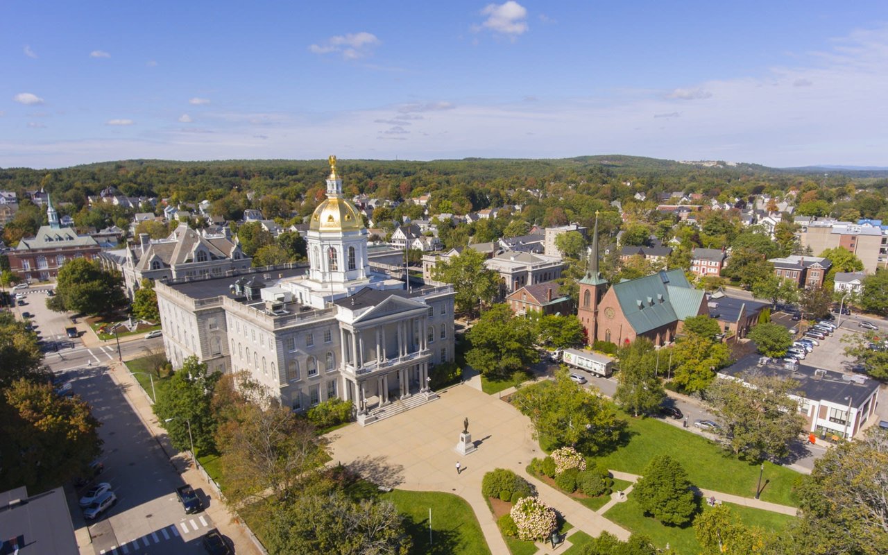
Manchester is New Hampshire's biggest city. The Merrimack River runs right through the middle, I-93 and the Everett Turnpike meet here, and every side of the city has its own kind of housing and its own feel.
I grew up on the East Side and I've spent my whole career helping people buy and sell here, so think of this as the quick version, the one I'd hand a friend.
"Where in Manchester?" is a real question here. Here's how I break it down.
There really is something for everyone.
Place | What's there |
|---|---|
A track and a walking loop around the pond | |
Lake Massabesic | It's the city's drinking water, so no swimming. But you can walk or bike the trails, and people fish, sail and kayak there. |
Rockingham Recreational Trail | Starts off Mammoth Road and runs along the lake |
Piscataquog Trail | Paved, on the West Side. It crosses the Merrimack on the Hands Across the Merrimack footbridge. |
Pine Island Park | City park out near the airport |
JFK Memorial Coliseum | The city's ice rink, with free skate |
The Merrimack River | Get out on it in a kayak or a boat |
Manchester is really well placed. Here's roughly how far everything is:
From Manchester to… | About |
|---|---|
Boston | 1 hour (about 50 miles on I-93) |
The beach | under an hour |
The Lakes Region | under an hour |
The White Mountains | 1.5 hours |
Concord | 18 miles |
Nashua | 18 miles |
Salem | 25 miles |
The two big highways meet right here. I-93 runs from Boston north to the White Mountains. The Everett Turnpike comes up from Nashua, and south of Nashua it turns into Route 3, which goes straight down to Burlington, Mass.
And we have our own airport, Manchester-Boston Regional (MHT), on the south end of the city. Being able to fly out of here instead of driving to Logan is awesome.
New Hampshire has no income tax and no general sales tax, so property tax carries a lot more of the load here.
The math is simple: your assessed value times the city's rate per $1,000. The rate is set every fall, and the city always posts the current one on its tax rates page.
The listings on this page update on their own, so what you see is what's actually out there.
The West Side, the North End, downtown and the Millyard, the South Side and the East Side. Each has its own housing, from early-1900s three-families on the West Side to 1950s–90s ranches and colonials on the East Side.
About 50 miles. That's roughly an hour straight down I-93, depending on traffic.
No. It's Manchester's drinking water. You can walk and bike the trails around it, and fish, sail and kayak on it.
Manchester-Boston Regional (MHT), on the south end of the city.
Your assessed value times the city's rate per $1,000. The rate resets every fall, and the current one is always on the city's tax rates page.
Thinking about a move to Manchester, or across town? Call or text me at 603-519-3310. Jess Provencher, Broker/Owner, Pro Homes.
115,415 people live in Manchester, where the median age is 37.9 and the average individual income is $44,220. Data provided by the U.S. Census Bureau.
Total Population
Median Age
Population Density Population Density This is the number of people per square mile in a neighborhood.
Average individual Income
Manchester has 49,546 households, with an average household size of 2.27. Data provided by the U.S. Census Bureau. Here’s what the people living in Manchester do for work — and how long it takes them to get there. Data provided by the U.S. Census Bureau. 115,415 people call Manchester home. The population density is 3,490 and the largest age group is Data provided by the U.S. Census Bureau.
Total Population
Population Density Population Density This is the number of people per square mile in a neighborhood.
Median Age
Men vs Women
Population by Age Group
0-9 Years
10-17 Years
18-24 Years
25-64 Years
65-74 Years
75+ Years
Education Level
Total Households
Average Household Size
Average individual Income
Households with Children
With Children:
Without Children:
Marital Status
Blue vs White Collar Workers
Blue Collar:
White Collar:
We know the Manchester area — what's selling, what's sitting, and what a house is actually worth right now. Whether you're buying, selling, or still figuring out your options, you'll get honest numbers and no pressure. There's no right or wrong here — just what's right for you.